Environmental Data Tools
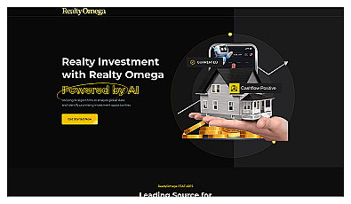
AI-driven insights for smart real estate investments.

Spatial data visualization and analysis for informed decision-making.

Real-time image analysis for accurate object detection.

Transform scans into detailed 3D building models instantly.
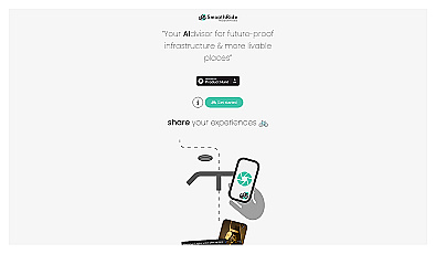
Urban planning tool promoting cyclist-friendly infrastructure improvements.

Geospatial AI for analyzing satellite and drone imagery.

Analog computing technology for fast and efficient AI processing.

Advanced mapping editor with AI features for accurate updates.
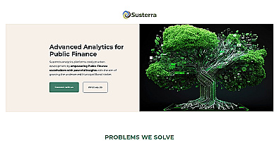
Advanced analytics for smarter public finance decision-making.

Advanced AI for fast analysis of geospatial imagery.
Capture detailed 3D models using your smartphone effortlessly.

Unlock insights from geolocation data for smarter decisions.
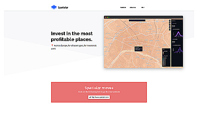
Real-time market insights for smarter real estate decisions.

Comprehensive location intelligence for businesses and applications.


Intuitive map editing with AI-driven insights for all users.

Advanced AI for swift visual data analysis and monitoring.

Efficiently manage and analyze large geospatial datasets.
Transform tree management with AI-driven insights and analytics.
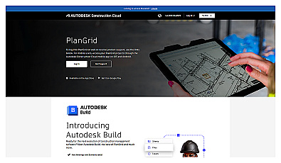
Access and share project information in real-time for construction teams.
Streamlined project management for home construction.
Visual documentation solution for construction projects

AI-driven tool for real-time asset tracking and management.
A collaborative management solution for construction teams.

Real-time construction project monitoring for effective management.