
Picterra
Geospatial AI for analyzing satellite and drone imagery.

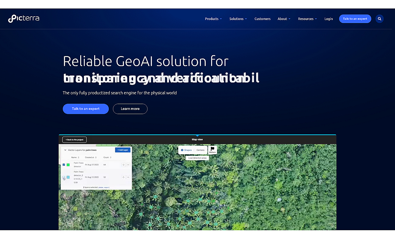
Picterra provides a platform for creating custom AI models that analyze satellite and drone images. It allows users to quickly identify objects, patterns, and changes in the environment.
This tool aids in monitoring land use and ensuring regulatory compliance. Organizations gain better transparency and sustainability in their operations through the insights offered by accurate geospatial data. With Picterra, businesses can make informed decisions that enhance efficiency and effectiveness.
The system supports various types of imagery and helps users understand complex data, driving positive outcomes across different industries.
- Monitor deforestation using satellite data
- Analyze crop health with drone imagery
- Track urban development patterns effectively
- Ensure EUDR compliance seamlessly
- Detect environmental changes in real-time
- Validate land plots for carbon credits
- Enhance mining safety with geospatial insights
- Streamline reporting for sustainability initiatives
- Improve infrastructure planning accuracy
- Facilitate supply chain transparency easily
- User-friendly interface for non-experts
- Customizable AI models for specific needs
- Rapid analysis of geospatial data
- Supports various types of imagery
- Facilitates compliance with regulations

Advanced AI for fast analysis of geospatial imagery.

Fast and accurate object detection for computer vision tasks.

Visualize and manage 3D geospatial data effortlessly.

Instant calculations and unit conversions in your browser.

Real-time video analytics for various industry applications.

AI-driven assistant for managing daily tasks and activities.

Engage with multiple AI models seamlessly and securely.
Product info
- About pricing: Subscription
- Main task: Geospatial analysis
- More Tasks
-
Target Audience
Environmental scientists Urban planners Supply chain managers Compliance officers Agricultural specialists