
Picterra
Geospatial AI for analyzing satellite and drone imagery.
Subscription
Advanced AI for fast analysis of geospatial imagery.
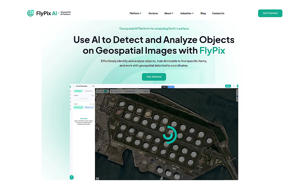
Flypix is an advanced system for analyzing geospatial images. It identifies and outlines various objects in complex scenes using powerful AI technology.
This system links geospatial data to specific coordinates, allowing users to train models to detect the items they need. Businesses save time by avoiding hours of manual image annotation, as Flypix performs this task in seconds. This leads to a smoother workflow, enabling users to concentrate on more important tasks.
It is useful in many areas, such as monitoring environmental changes, checking crop health, tracking construction projects, and planning urban development. Flypix streamlines the way industries work with imagery and enhances overall efficiency.
Based on overlapping tasks and related categories.
Geospatial AI for analyzing satellite and drone imagery.

Spatial data visualization and analysis for informed decision-making.
Fast and accurate object detection for computer vision tasks.
Comprehensive suite for software development and operations management.
No-code AI workflow engine for enhanced productivity.

Create custom applications without coding expertise.
Discover other similar tools and compare features