
Esri
Spatial data visualization and analysis for informed decision-making.
Efficiently manage and analyze large geospatial datasets.
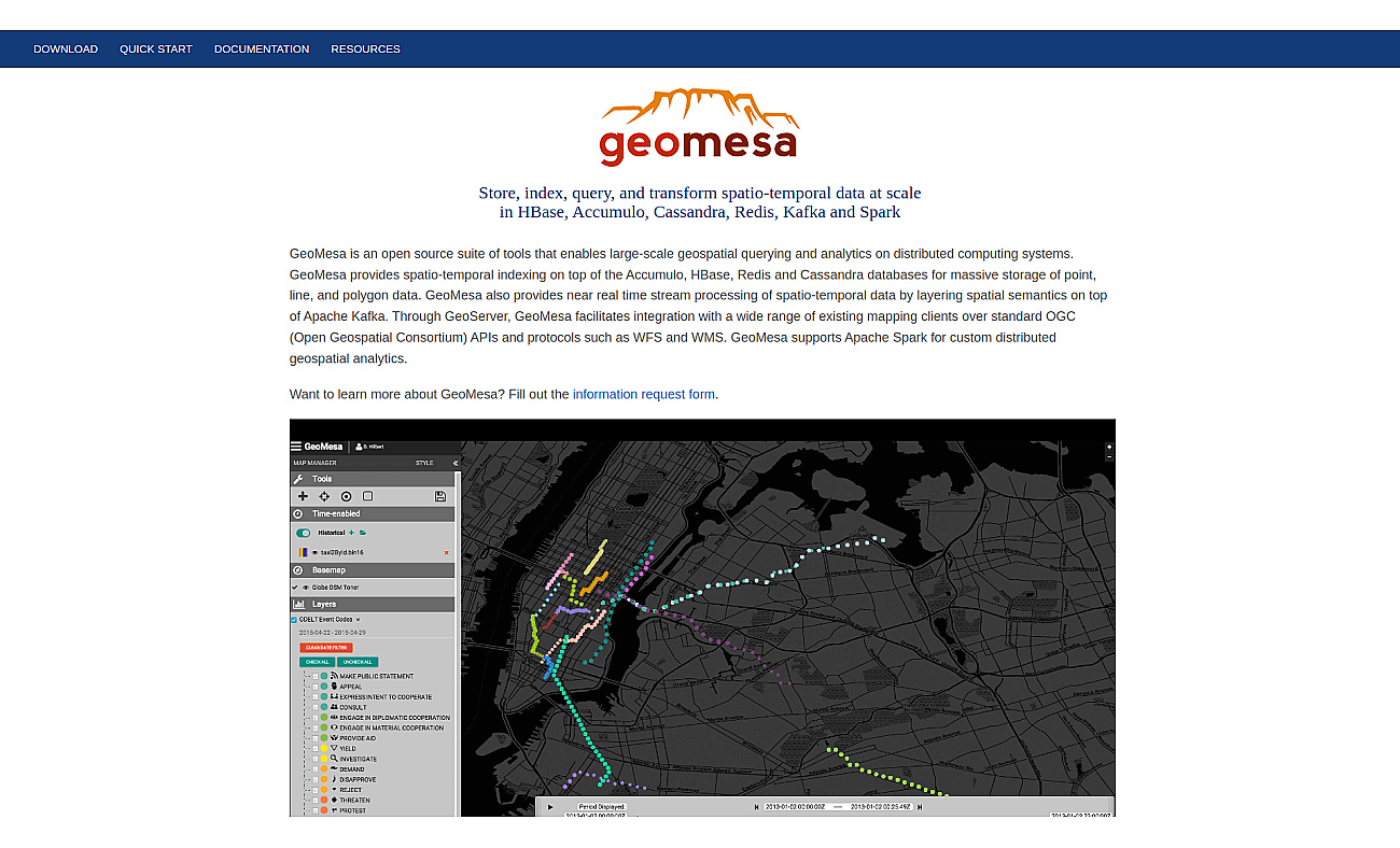
GeoMesa is a system for managing geospatial data, allowing organizations to store and analyze information about locations effectively. This system works with various types of data, including points, lines, and polygons, enabling fast and scalable queries.
It connects with popular databases like HBase, Accumulo, and Cassandra, making it easier to handle large datasets. With the ability to process data streams through Apache Kafka, real-time analytics becomes feasible. Organizations benefit from insights into their geospatial data, which is essential for industries such as transportation, urban planning, and environmental monitoring.
Based on overlapping tasks and related categories.
Spatial data visualization and analysis for informed decision-making.

Advanced AI for fast analysis of geospatial imagery.
Serverless vector database optimized for AWS environments.
Build real-time data pipelines for smarter decision-making.
Database for efficiently managing large AI datasets.

Unified data management for enhanced business insights and agility.
Discover other similar tools and compare features