GeoSpy

GeoSpy

AI-driven image analysis for precise location identification.

Visit Website
GeoSpy screenshot

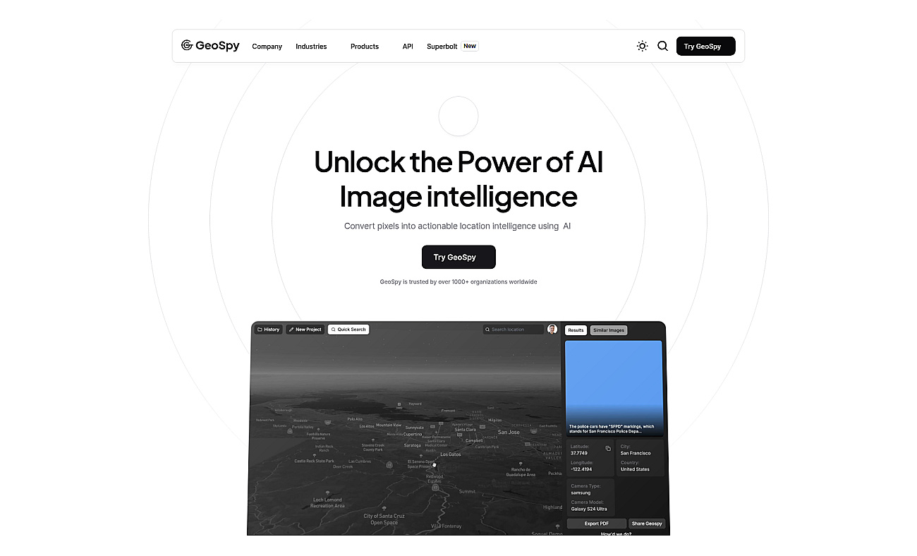
GeoSpy is an advanced image analysis system that uses artificial intelligence to determine precise GPS locations from images, even if they lack metadata. It efficiently processes thousands of images every day, providing real-time location insights from anywhere in the world.

This software finds applications in various fields, such as urban planning, crime scene investigations, disaster response, and environmental monitoring. Government agencies and businesses benefit from its accurate geographic data, which aids in logistics, tourism tracking, and land use assessments. With its user-friendly interface and global coverage in over 120 countries, GeoSpy makes location intelligence accessible and effective for a wide range of users.


  • Analyze urban planning photos
  • Enhance crime scene investigations
  • Support disaster response efforts
  • Aid in land use assessments
  • Improve tourism location tracking
  • Streamline logistics and delivery
  • Facilitate environmental monitoring
  • Assist in real estate evaluations
  • Optimize transportation route planning
  • Boost marketing strategies with location data
  • High accuracy in location prediction
  • User-friendly interface for easy access
  • Global coverage in over 120 countries
  • Scalable for large image processing
  • Supports various deployment options


Here Technologies

Comprehensive location intelligence for businesses and applications.

Customvision.ai

Create custom image recognition models with ease.

api4ai

Cloud-based APIs for efficient image analysis and processing.

Flypix

Advanced AI for fast analysis of geospatial imagery.

Esri

Spatial data visualization and analysis for informed decision-making.

U-Net

Advanced image segmentation solution built on TensorFlow.

GeoMesa

Efficiently manage and analyze large geospatial datasets.

V7

Automates data processing and labeling for improved workflows

Product info